φ21°33', λ41°21'
Ecology Information No. 2
February, 2007
|
| 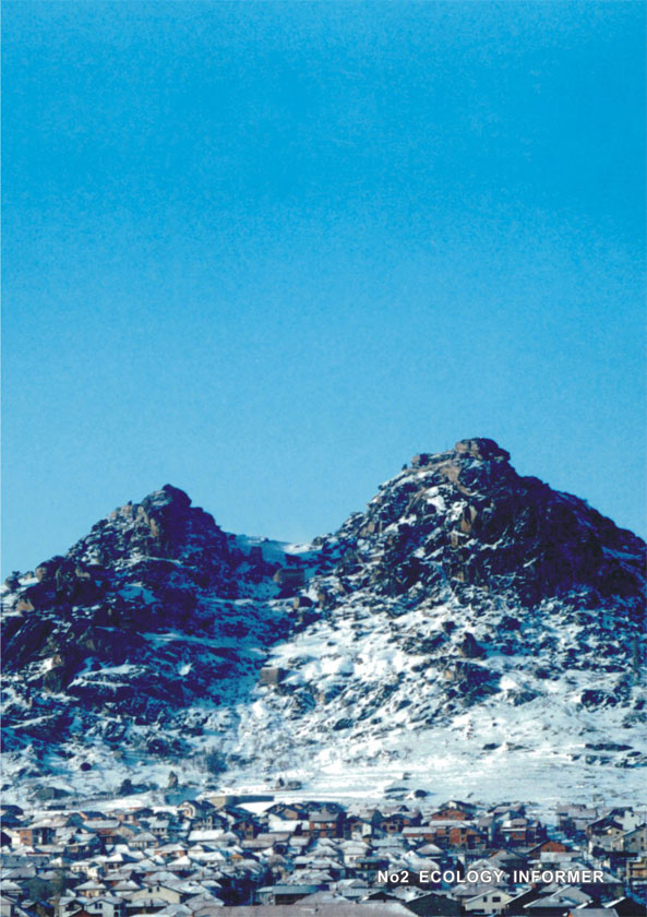 | 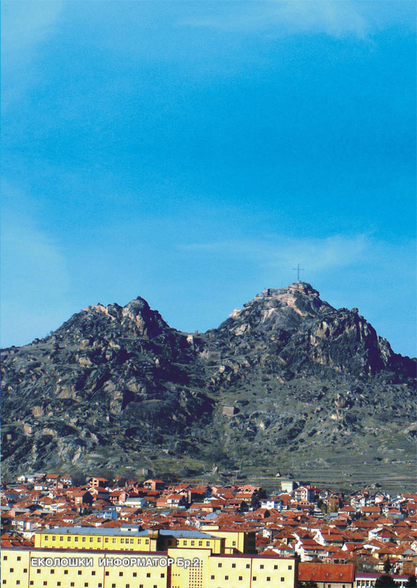 |
Marko's Castle
In the long history of settlement of the Balkans, the importance of the castle of King Marko was closely related to its suitable location. It is situated on the northeast margin of Pelagonia basin, encircled by hardly accessible mountainous belts. Two strategically important communications passed through this plain: Via Egnatia and Via Militaris. The castle is built on a natural rocky elevation, which peak of above 951 m above sea level, with its characteristic shape, dominates over the town of Prilep. The hardly accessible and steep terrain, strengthened with several more defensive fortifications, have made this settlement an invincible citadel. For centuries and centuries, settlements of various character and intensity had been carried out on the foot of the hill. The oldest settlement dates from the late neolith and early bronze period and it was intensified in Hellenic and Romanic period. During the rule of Czar Samuil, the fortress became one of the most important fortification points in Macedonia. It maintained its significance throughout Middle Ages, being in one period a capital f the so called Prilep Kingdom of legendary hero Marko, after whom it was named Markovi Kuli (Marko's Castle). By the middle of the XVII C the life in the fortress gradually disappeared and it lost its strategic function. Archaeological investigations of the locality Markovi Kuli revealed a fortune of architectural forms and applied technical principles in building, with marks of highest mastership of construction techniques. The photogramic research determined a regular topography of the fortress, together with the names of peaks and regions around it, and conservation-restauration works have been carried out on many objects and on the system of fortification, including parts of defense walls and some of the towers. The complex of Marko's Castle consists of numerous, diverse, small denudation forms, which make an extraordinary fine sculpture of the whole relief. All this massif is distinguished by a variety of strange, sometimes even fantastic forms of peaks, columns, teeths, mushrooms, balls, zooglyphs (elephant, turtle, lion, lizard) as well as cave and kettle niches. Some of these complex geomorphological shapes dominate over the area by their gigantic size. Shapes like these can be monitored in other locations near Prilep, from Mariovo to Kajmakcalan, but concentration and diversity of micro-relief forms like those of Marko's Castle could not be matched by anything in wider area. The richness of forms created throughout a long geological history, their numerousity and diversity of shapes distributed over a large area give this landscape a unique value, due to which this magnificent object of nature presents a rarity for Europe and for the World. M-r Roza Topuzova Karevska |
photography,
Milan Temelkoski, 2001 Geological characteristics of Prilep
The town of Prielp is located in the southeast of the Republic of Macedonia and is a part of the metamorphic complex Pelagonia as a wider geological area. Pelagonia (Pelagonia and Mariovo) is a relatively big region spread in the southeast part of R. Macedonia on an area of about 4500 km2. The position of this region is approximately meridional, i.e. in NW - SE direction, about 85 km long and 65 km wide. In general, this region consists of two parts: Pelagonia and Mariovo. Pelagonia is also divided into two parts: Prilepsko Pole and Bitolsko Pole, while in the south of this region is Lerinsko Pole, which belongs to Greece. Pelagonia and Mariovo region is naturally and clearly bounded with mountains Baba and Pelister to the west and with the Kozjak massif to the southeast. 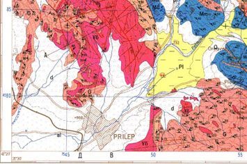 The main lithostratigraphic properties of Pelagon are result of the primary accumulation of pelite-psammite and carbonate sediments followed by poorly represented initial magmatism. During the period of Grenvillian orogenesis, these complexes went through metamorphic-magmatic and tectonic processes due to which they were metamorphosed in metamorphic rocks of epidote-amphibolite facies. In the Grenvillian matamorphic complex on the territory of Pelagon, a lower and upper part can be distinguished. The lower part is represented by series of gneiss and mica schist, and the upper part by mixed series and series of marbles. Beside this, the lower part of the metamorphic complex is connected to granitoid bodies of the type of Prilep granitoids, which in this part of Pelagon are joined mainly with the terrains of Babuna. The oldest rocks in this area are the banded gneisses (G). They are precambrian rocks old about billion years. Their color is light reddish, and those rich in liscun are grey-greenish. Depth of the gneiss series is estimated about 1000 to 1500 meters. Marbles (M) represent the topmost part of the precambrian complex in Pelagon. They are the ultimate member of the metamorphic complex with high crystality, laid transgressively above gneisses. Depth of the marble series is 2000-3000 meters. Two kinds of marbles can be distinguished: massive dolomite (Md) and cipoline and marble (Mm). The former are known under the brand Sivec - milky-white marble, one of the most demanded in the world market. Granitoid formation is formed by expanded areas, known in literature as "the Prilep granites". Size of the bodies ranges from 0.5 km2 to several square kilometers. Predominant in this formation are the granodiorites, with their massive texture and light-grey color. All granitoids belong to a single magmatic cycle, created in several stages. Sands and clays (Pl) are plyocene creations, found most frequently along the valley of Pesterica river. Sandy series is of a homogenous composition, represented by sands and clays. Fossils of Pikermi fauna were also traced in them: mastodons, gazelles, pigs, giraffes, rhinoceros, antelopes, etc. In that period, the border of Pelagonia basin had been covered with the plyocene lake of the same name. The holocene epoch is represented by deluvium (d) and alluvium, i.e. modern age sediments formed by the descent of the erosion base of surrounding rivers, caused by tectonic movements and changes in the climate. Vasja Dameski, eng. geologist |
Morning View,
Petre Nikoloski, 2006 | | 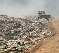
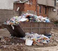
A dump in Prilep,
Petre Nikoloski, 2006 |
FLORA AND FAUNA IN PRILEP World standards for green area per inhabitant is approximately 20 square meters, and in Prilep this figure does not exceed 1 m2. This is so because the only green space in Prilep is: lime-tree alley in the center of the city, which are now badly damaged and have lost their recognizable look, the horse chestnut along Marksova Street, which have been also mutilated quite unprofessionally, some trees in the yards of greenery loving citizens, the Park of the Revolution, which should have been rearranged some ten years ago, locality Satorov Kamen, previously afforested with acacia and pine, and now, unfortunately, devastated completely, and finally the Artificial Lake, afforested in the 70-ties with black pine and now the aim of illegal tree cutting which seriously diminishes the already low level of wood resources. Thus, the complete picture of Prilep in this segment is terrifying. It is supported by the latest information of the LEAP (Local Ecological Action Plan), according to which only 3% of the total area is covered with green mass, and this is dangerously close to wasteland. 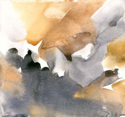
Water color; Flora Fauna
Ilija Minoski,2006
The situation with fauna is not much better, due to the fact that the nearest woods are about 50 km out of Prilep, and they are natural habitats of game. The most frequently represented game is: wild boar, fawn, hare, partridge, pheasant and other species which are highly important from the hunting and economic point of view, but their number is constantly decreasing because of the poachers. In the urban part of Prilep, the most numerous bird species are jackdaws which, due to the vicinity of dump with not a single tree around it, make their nests in the mere center of the city. According to the inhabitants of Prilep these birds are harmful, but in nature they are considered as useful natural cleaners of the polluted environment. Some hope for Prilep to resemble a pleasant surrounding lies in the small number of songbirds like nightingale, finch, goldfinch etc., which by their color and diversity of songs are unique not only in Prilep but wider in the region, in areas with lower air pollution. Hilda Crneska, forestry engineer
Photography,
Petre Nikoloski, 2006 | |